
Size of US States by Area
The vastness of the US countryside. View of the Navajo Nation’s high desert plain in New Mexico as viewed from the foot of Shiprock mountain.
Also Read:- 2024 Presidential Election Interactive Map
From the largest to the smallest US states.
The third-largest nation on earth, the United States takes up little under 40% of the North American continent.
There are 50 states that make up the US territory; 48 of them are located in what is known as the “contiguous United States,” a peninsula-like region in the middle of North America; one, Alaska; and one, Hawaii, a tropical archipelago in the Pacific Ocean.
The United States is made up of the states, which are its fundamental political divisions.
Colonial charters had a key role in defining the 13 initial states’ borders, which changed frequently over the course of history. Congress set the boundaries of numerous more state territories. The size of the states west of the Mississippi was determined by relatively arbitrary straight lines that were drawn along the lines of longitude and latitude.
The size of US states can be compared to that of nation-states in the Old World. For instance, the third-largest US state of California is bigger than Germany but smaller than France; Texas is three times larger than the UK; and Massachusetts is smaller than Switzerland by two-thirds.
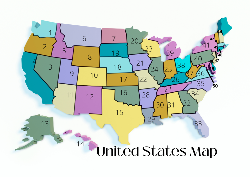
The 50 US States are listed below in order of size of area. United States states are listed from largest to smallest.
List of states and territories, ordered by total area in square miles and square kilometres (km2).
US State Flags:
Click on a state flag symbol to show a larger version of the flag and a flag description.
| No. | State | km² | sq mi | Census Region | Notes | |
|---|---|---|---|---|---|---|
| 30 | Alabama | 135,767 | 52,420 | East South Central | The “Heart of Dixie” is the largest state in East South Central region. | |
| 1 | Alaska | 1,723,336 | 665,384 | Pacific | The largest US state, Alaska, shares no borders with any other US state. The least densely populated US state, “The Last Frontier,” is about three times the size of France. | |
| 6 | Arizona | 295,233 | 113,990 | Mountain | Home to the Grand Canyon. Arizona is about three times the size of South Korea. | |
| 29 | Arkansas | 137,730 | 53,178 | West South Central | By comparison, Arkansas is slightly larger than Greece. | |
| 3 | California | 423,968 | 163,695 | Pacific | one of three states on the US mainland with a Pacific Ocean coastline, and the largest state in the Pacific region. California’s size dwarfs Austria by a factor of five. | |
| 8 | Colorado | 269,602 | 104,094 | Mountain | One of the two states with boundaries that appear to form a rectangle and are straight. Colorado is nearly the size of New Zealand. | |
| 48 | Connecticut | 14,356 | 5,543 | New England | One of the six New England states, but nine times smaller than England. | |
| 49 | Delaware | 6,446 | 2,489 | South Atlantic | One of the original thirteen states. | |
| 22 | Florida | 170,312 | 65,758 | South Atlantic | largest state in the United States’ South Atlantic area. Spain is around one-third the size of Florida. | |
| 24 | Georgia | 153,910 | 59,425 | South Atlantic | One of the original thirteen states. | |
| 43 | Hawaii | 28,313 | 10,932 | Pacific | The only US state located on an archipelago. | |
| 14 | Idaho | 216,443 | 83,569 | Mountain | By comparison, Idaho is slightly smaller than Great Britain (island). | |
| 25 | Illinois | 149,994 | 57,913 | East North Central | By comparison, Illinois is about half the size of Italy. | |
| 38 | Indiana | 94,327 | 36,420 | East North Central | Indiana is about the size of Hungary. | |
| 26 | Iowa | 145,744 | 56,272 | West North Central | By comparison, Iowa is about twice the size of Ireland. | |
| 15 | Kansas | 213,099 | 82,278 | West North Central | Only the northeast corner of Kansas is cut off by the Missouri River; the size of Kansas is determined by longitude and latitude. | |
| 37 | Kentucky | 104,656 | 40,408 | East South Central | The Bluegrass State would fit nearly seven times into Texas and is roughly one-third the size of Poland. | |
| 31 | Louisiana | 135,658 | 52,378 | West South Central | The Pelican State is somewhat larger than Greece, or about half the size of Colorado. | |
| 39 | Maine | 91,634 | 35,380 | New England | Largest state in New England. About twice the size of Estonia. | |
| 42 | Maryland | 32,131 | 12,406 | South Atlantic | Maryland is slightly larger than Belgium, about 26% of its area is water. | |
| 44 | Massachusetts | 27,335 | 10,554 | New England | The most populated state in the New England region and a little bit smaller than Belgium is the Commonwealth of Massachusetts. | |
| 11 | Michigan | 250,485 | 96,713 | East North Central | Largest state in East North Central, but 40,175 sq mi (104,052 km²) are water area, 41.5% of the state is liquid. | |
| 12 | Minnesota | 225,163 | 86,936 | West North Central | Largest state in West North Central, has a border with Canada. | |
| 32 | Mississippi | 125,438 | 48,432 | East South Central | The Mississippi River, the second-longest river in the US, inspired the naming of Mississippi. | |
| 21 | Missouri | 180,540 | 69,707 | West North Central | The Missouri River, the nation’s longest river, inspired the naming of Missouri. | |
| 4 | Montana | 380,832 | 147,040 | Mountain | The Mountain Region’s largest state is Montana. Japan is a little bigger than Montana. | |
| 16 | Nebraska | 200,330 | 77,348 | West North Central | Nebraska, which is almost twice the area of Iceland, is located in the centre of the US to the west of the Missouri River. | |
| 7 | Nevada | 286,380 | 110,572 | Mountain | Nevada, the Battle Born State, is about three times the size of Portugal and would fit into Texas almost 2.5 times. | |
| 46 | New Hampshire | 24,214 | 9,349 | New England | The Granite State is slightly larger than one-third of Ireland and would fit into Texas 29 times. | |
| 47 | New Jersey | 22,590 | 8,722 | Middle Atlantic | The US state with the highest density of people is New Jersey. In comparison, it is around the same size as Israel and has a similar population. | |
| 5 | New Mexico | 314,917 | 121,590 | Mountain | The fifth-largest US state, New Mexico is roughly the size of Poland. At 2,194 m (7,198 ft) above sea level, Santa Fe, the capital of New Mexico, is the highest capital city in the country. | |
| 27 | New York | 141,297 | 54,555 | Middle Atlantic | in the Middle Atlantic region, the biggest state. The “Empire State” would fit within Texas nearly five times and is a little bigger than Greece. | |
| 28 | North Carolina | 139,390 | 53,819 | South Atlantic | North Carolina is around five times the size of Texas and is roughly twice the size of Ireland. | |
| 19 | North Dakota | 183,107 | 70,698 | West North Central | Although it is eight times larger than New Jersey, North Dakota is only slightly smaller than half the size of Germany. | |
| 34 | Ohio | 116,096 | 44,825 | East North Central | The Buckeye State is slightly larger than Cuba and would fit six times inside Texas. | |
| 20 | Oklahoma | 181,038 | 69,899 | West South Central | Oklahoma is the size of Cambodia, and it would fit almost four times in Texas. | |
| 9 | Oregon | 254,800 | 98,379 | Pacific | one of the three states with a Pacific Ocean coastline on the continent of America. Despite having only around 6% of the UK’s population, Oregon is only slightly larger than the UK. | |
| 33 | Pennsylvania | 119,279 | 46,054 | Middle Atlantic | Pennsylvania, sometimes referred to as “The Keystone State,” is roughly equal to the size of the UK. | |
| 50 | Rhode Island | 3,999 | 1,544 | New England | Rhode Island is the smallest U.S. state. It would fit more than 40 times in England. | |
| 40 | South Carolina | 82,931 | 32,020 | South Atlantic | South Carolina is about as big as the United Arab Emirates. | |
| 17 | South Dakota | 199,730 | 77,116 | West North Central | South Dakota is two-thirds the size of Italy. | |
| 36 | Tennessee | 109,152 | 42,144 | East South Central | Tennessee is about the size of Cuba. | |
| 2 | Texas | 695,660 | 268,596 | West South Central | The largest state on the U.S. mainland and the second largest in the United States. | |
| 13 | Utah | 219,882 | 84,897 | Mountain | The Beehive State is about twice as big as Bulgaria. | |
| 45 | Vermont | 24,905 | 9,616 | New England | The state in the northeastern US is about half the size of Slovakia. | |
| 35 | Virginia | 110,787 | 42,775 | South Atlantic | Virginia is about the size of Bulgaria. | |
| 18 | Washington | 184,661 | 71,298 | Pacific | Washington is one of thirteen states that share a border with Canada and one of three states on the US mainland that have a coastline on the Pacific Ocean. | |
| 41 | West Virginia | 62,755 | 24,230 | South Atlantic | The only state wholly included within the Appalachian Mountains is The Mountain State. Scotland is a little smaller than West Virginia. | |
| 23 | Wisconsin | 169,634 | 65,496 | East North Central | The Badger State is about twice the size of Austria. | |
| 10 | Wyoming | 253,334 | 97,813 | Mountain | The lines at 104 and 111 degrees west longitude and 41 and 45 degrees north latitude divide Wyoming, which is half the size of Spain. It is the second-least populated state in the US. |
| Country/ Territory |
Area (km²) |
Area (sq mi) |
Territory | Notes | |
| United States
Contiguous United States |
9,833,516
8,081,868 |
3,796,742
3,120,428 |
North America | The third-largest nation in the globe is the United States. Its size is more than twice as large as the European Union or almost half that of Russia. There are 50 states and one capital district in the federal republic (District of Columbia). | |
| District of Columbia | 177 | 68.34 | South Atlantic | Capital district of the United States, generally known as Washington D.C. |
| Territories of the United States | |||||
| American Samoa | 1,505 | 581 | Polynesia | American Samoa has a land area of 198 km² (76 sq mi) | |
| Guam | 1,476 | 570 | Micronesia | Guam has a land area of 543 km² (209 sq mi) | |
| Northern Mariana Islands | 5,115 | 1,975 | Micronesia | Northern Mariana Islands have a land area of 472 km² (182 sq mi) | |
| Puerto Rico | 13,792 | 5,325 | Caribbean | Puerto Rico has a land area of 8,867 km² (3,424 sq mi) | |
| US Virgin Islands | 1,898 | 733 | Caribbean | US Virgin Islands have a land area of 348 km² (134 sq mi) | |